

Przegląd projektu
The municipalities of Osiek Jasielski and Krempna were developing a shared cycling tourism offer through the Elektromobilne Pogranicze PL-SK project. Our task was to build an app that helps visitors choose a route, understand its course and plan stops at local attractions. We delivered a browser-based guide that can also be installed on a phone. The published catalogue contains 11 routes with a combined length of 326.2 km, alongside maps, ride information and GPX files. The municipalities can update this information through the content management panel provided with the project.
Wyzwanie
Before a ride, visitors need to know whether a route suits their abilities, how long it may take and what they can see along the way. The app had to bring together information from two municipalities, work comfortably on a phone and let staff keep the offer up to date.
Choosing a suitable ride
A route name alone is not enough. Distance, difficulty, elevation gain and estimated riding time needed to be clear while comparing options.
Maps and navigation
Descriptions needed to connect to the actual route on a map and a GPX file that cyclists could use on their own navigation device or app.
Two municipalities, one catalogue
Osiek Jasielski and Krempna needed a consistent presentation of routes and attractions. The cross-border project also required Polish and Slovak versions.
Keeping the guide current
Updating routes, photos and news needed to work without changing application code. Staff required an editorial panel and documentation for ongoing content management.
Nasze rozwiązanie
We built a PWA with a route catalogue, interactive maps and a CMS. The work included the software, tourism content, photos and handover materials for both municipalities. Visitors can access the same guide on a computer or phone.
From the first route to the full catalogue
We delivered the project in two stages. A shared route of approximately 54 km was made available for the July cycling rally. We then added ten more routes, five for each municipality. This gave the event its first published route before the remaining catalogue was completed in the second stage.
Route comparison before detailed planning
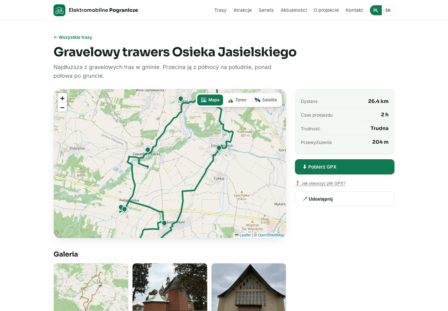
Each route has its own page with distance, estimated riding time, difficulty and elevation gain. Catalogue filters let visitors narrow the selection by municipality and difficulty. Cyclists can choose a suitable ride before opening the detailed description and map, rather than searching through long descriptions for basic information.
Interactive maps and GPX downloads
Route pages show their course on an OpenStreetMap map, with terrain and satellite layers available. We added points along the route, GPX downloads, instructions for opening the file and link sharing. Visitors can explore the course in the guide and then use their preferred navigation tool during the ride.
Attractions connected to the journey
We prepared descriptions and photo galleries for local attractions and connected them to routes. Separate sections cover service information and news. The guide goes beyond drawing a line on a map by showing places worth stopping at. Content was prepared using collected data, documentation and fieldwork.
Mobile access in Polish and Slovak
We adapted the interface for small screens, keeping route information and the GPX download accessible on the route page. Visitors can open the app from a link or install it as a PWA on their phone. Polish and Slovak versions make the same tourism offer available to audiences on both sides of the border.
Editorial tools and project handover
The municipalities received a Payload CMS panel for managing routes, attractions, photos and news. We handed over the source code and documentation and prepared the application’s hosting setup. The result is a working guide with 11 routes that the client can maintain and develop as the local tourism offer changes.
Describe what you want to improve - quote in 24h
Tell us what you need - automation, integration, AI agent or an app. You get a concrete quote for exactly what you want: what we'll do, what it costs and when it goes live.
Zakres usługi
Tourism PWA
Technologie
Galeria projektu
Chcesz podobnych wyników?
Umów się na bezpłatną konsultację i sprawdź, jak AI może pomóc Twojemu biznesowi.
Umów bezpłatną konsultację