

Project overview
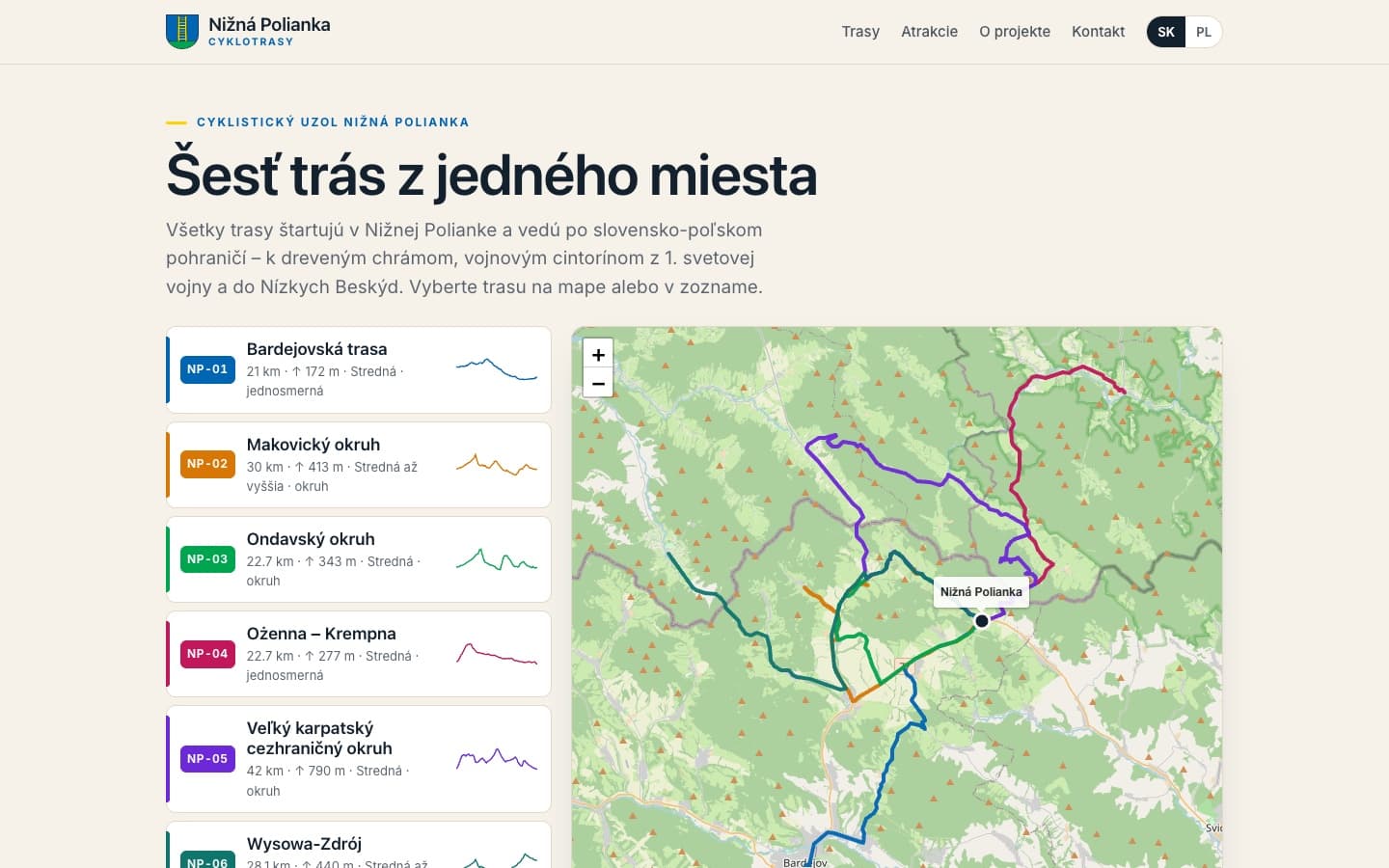
The municipality of Nižná Polianka was running the Interreg project “Elektromobilné pohraničie PL-SK”. It needed a guide that shows cyclists the local routes and places worth visiting. In October and November 2026 we built a PWA with six routes totalling 166.5 km and a catalogue of 26 attractions. The app runs on the municipality's own server under its domain, and the office updates content itself in the CMS, using a manual written in Slovak.
The challenge
A cyclist has to choose a route before setting off, and in the hills needs a map even where coverage is weak. The municipality also needed a tool its office can maintain on its own, in Slovak and in Polish.
Choosing a route before the ride
Length, elevation gain, time and difficulty of every route have to be visible at once, before anyone gets on the bike.
A map without signal
Mobile coverage in the hills can be weak, so the map has to be downloadable to the phone and usable offline, together with the GPX file.
Two languages, two sides of the border
The cross-border project required content and interface in both Slovak and Polish.
Self-service editing
The office has to add routes, attractions and news by itself, with separate roles and without depending on a developer.
Our solution
We reused the proven solution from the app built for Osiek Jasielski and Krempna and adapted it to Nižná Polianka. That let the whole scope, from contract to acceptance, fit into five weeks.
Six routes with complete data
Routes NP-01 to NP-06 each have a page with a map, elevation profile, length, elevation gain, time, difficulty and description. Each can be downloaded as GPX or shared by link.
Offline map and phone install
The app installs as a PWA. The map of a chosen route can be downloaded in advance and used on the trail without signal.
A catalogue of 26 attractions
We described the places worth a stop and grouped them by village, with filters and photos.
CMS, deployment and handover
An admin panel with administrator, editor and moderator roles, a contact form with spam protection, and deployment on the municipality's server with SSL and daily backups. We handed over the source code and a 43-page CMS manual in Slovak.
Describe what you want to improve
Tell us what you need - an app, website or store, an integration or an AI agent. You get a concrete quote for what you want: what we will do, how much it costs and when we can start.
Technologies
“The work was delivered in the agreed scope, on the agreed date, and is in live operation. We rate the cooperation positively.”
Mgr. Ján Cundra
Mayor of Nižná Polianka — signed reference dated 18 November 2026
Project gallery
Planning a similar project?
Book a free consultation to discuss your project.
Book a free consultation